Agriculture is still a rather conservative and inert industry. In the cultivation of crops, little has changed over the centuries since the innovations of the horse-drawn plow and three-field farming. Significant changes happened relatively recently, just decades ago, with the introduction of agrarian chemicals, the appearance of hybrid varieties of grains, artificial insemination, and advanced farm machinery.
In the beginning of the 21st century, the potential of these innovations to further increase agricultural productivity seemed to be exhausted, and the progress had slowed. Since then, farmers have been persistently introduced to new advanced technologies: nano, bio, and AI mostly. And the access to these technologies and their benefits is usually provided through farm software, which is now able to help with crop health tracking, fertilization, creating a crop map, weather analytics, and much more.
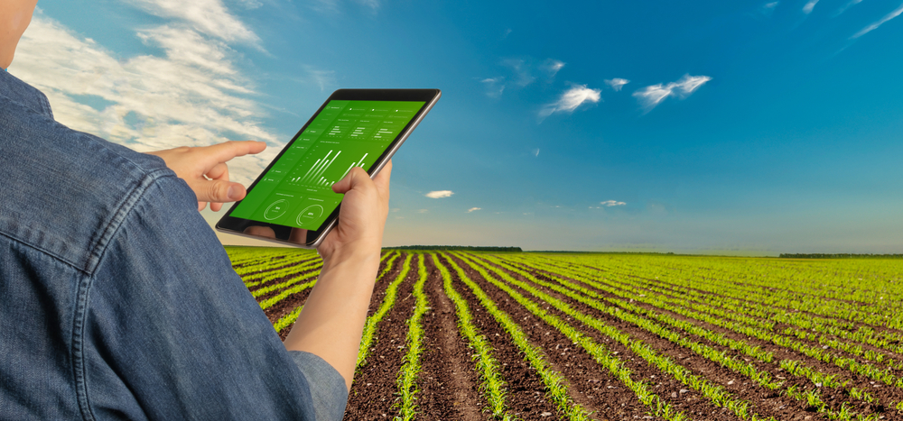
The Concept of a Crop Management Software
Modern technology contributes to the accumulation and dissemination of knowledge and experience of agricultural production, introducing best practices. Apps and software products can improve the efficiency of plant nutrition management, optimize the use of fertilizers in a sustainable production system, create a crop rotation map and more. As soon as smartphones became popular, they were used in agricultural management as a decision-support tool. Today, mobile devices can help farmers around the world apply best practices in crop management. More so, smartphones with their intuitive controls and simple interface do not require the user to be IT-literate.
For a long time already, special software has existed and has been widely used, thanks to which it is possible to monitor malfunctions of machinery, control the progress of sowing and land bank processing, and plan field work. In some systems it is also possible to display the current weather, information about the germination of crops, accounting information about expenses and presence of products, data on crop rotation and crop production thanks to a crop map, GPS-monitoring of transport, fuel expenses, etc.
Ways Technology Enhances Crop Management
Now, let’s focus in detail on the top cases of using software for smart crop tracking and management.
Crop Mapping and What They Uncover
Crop maps are essential for tracking and managing land use and tracking crop production, be it a world crop map or the one for a particular country or region. Such maps depict the types of agricultural crops growing in a particular area, the territory each crop covers, and at what stage of development each crop is at a particular time. A crop map could also provide information on vegetation indices measurements, the dates seeding and harvesting were carried out, soil moisture, and more. However, these types of data are not part of a standard crop map and are usually custom projects.
One provider of a crop mapping software is EOS Data Analytics — a company specializing in AI-powered satellite imagery analytics. Two main crop mapping technologies the company offers by default are detection of field boundaries detection and classification of crop types. To detect and map crops, both satellite and ground-based data are collected and analyzed. The company’s crop production map of Ukraine is an example of this technology implementation. The map offers data on registered and unregistered lands, crops produced in a particular season, total area each crop covers in a selected area, district, or the whole territory of Ukraine, and custom rotation data if requested.
Weather Analytics
Weather forecast has always been one of the sore points for farmers. After all, it is the weather that affects the ability to conduct most agricultural operations. Thanks to different farm software that includes weather data, farmers are provided with a detailed weather forecast and historical weather to help them analyze local weather patterns and carry out agricultural activities accordingly.
Fertilizer Application
Improper use of fertilizers can be very dangerous: apart from directly reducing crop yields, long-term excessive use of chemical fertilizers leads to contamination of soil and groundwater, while insufficient fertilizer application leads to soil degradation and a decline in agricultural potential.
Often the problem lies in the fact that the distribution of fertilizers across the field doesn’t account for the need of each field zone, meaning a single rate of fertilizer application is set for the whole field.
Farm software solves this issue by offering necessary data for the implementation of variable rate application, which means fertilizer doses are set depending on soil and crop needs in a particular field zone. The key to such precision is digital field maps, usually created using satellite imagery and vegetation indices data. With such maps, farmers can make smart decisions on fertilizing different field areas based on their current needs, saving resources, money, and ensuring sustainability.